- What is Surveying
- Why are surveys so expensive?
- When should I have my property Surveyed?
- Tips for Landowners
- What is a Flood Certificate aka Elevation Certificate aka Flood Insurance Certificate?
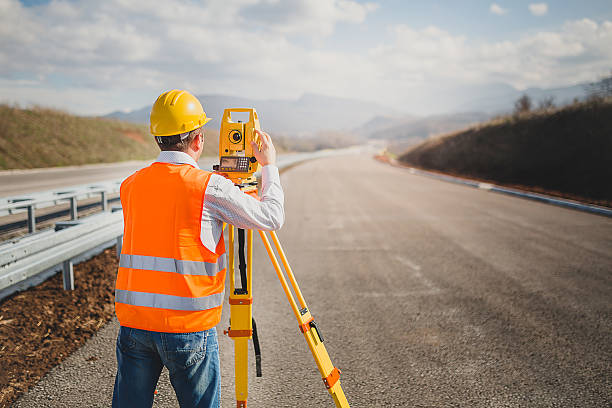
What is Surveying?
The International Federation of Surveyors defines the function of surveying as follows:[1]
A surveyor is a professional person with the academic qualifications and technical expertise to conduct one, or more, of the following activities;
- to determine, measure and represent land, three-dimensional objects, point-fields and trajectories;
- to assemble and interpret land and geographically related information,
- to use that information for the planning and efficient administration of the land, the sea and any structures thereon; and,
- to conduct research into the above practices and to develop them.
Wikipedia defines Surveying or land surveying as
Land Surveying is the technique, profession, art, and science of determining the terrestrial or three-dimensional positions of points and the distances and angles between them.
https://en.wikipedia.org/wiki/Surveying
A land surveying professional is called a land surveyor. These points are usually on the surface of the Earth, and they are often used to establish maps and boundaries for ownership, locations, such as the designed positions of structural components for construction or the surface location of subsurface features, or other purposes required by government or civil law, such as property sales.
Surveyors work with elements of geometry, trigonometry, regression analysis, physics, engineering, metrology, programming languages, and the law. They use equipment, such as total stations, robotic total stations, theodolites, GNSS receivers, retroreflectors, 3D scanners, LiDAR sensors, radios, inclinometer, handheld tablets, optical and digital levels, subsurface locators, drones, GIS, and surveying software.
Surveying has been an element in the development of the human environment since the beginning of recorded history. The planning and execution of most forms of construction require it. It is also used in transport, communications, mapping, and the definition of legal boundaries for land ownership, and is an important tool for research in many other scientific disciplines.” https://en.wikipedia.org/wiki/Surveying
Why are surveys so expensive?
The Minnesota Society of Professional Surveyors helps us understand the cost…
“The most important factor in the cost of surveys is the amount of labor required. Every object shown on a survey drawing, whether it is a survey marker, a house, a fence, or a tree, must be accurately measured on the ground. When property lines are being located, measurements must be taken not only to survey markers on the property being surveyed, but also to other markers in the area-sometimes up to a mile away. Calculations then need to be done, and drawings prepared.
Surveyors must keep detailed and accurate records of all measurements and calculations, since they may be needed as evidence if there is a legal dispute in the future. Documents such as deeds, plats, and easements may need to be obtained from the public records and reviewed.
All survey work needs to be done by trained and experienced persons. Otherwise, the work might not meet legal standards or provide adequate protection for your property rights.” https://www.mnsurveyor.com/page/surveying_FAQs
Modern survey equipment is highly accurate, but also costly. Because of the amount of labor required, a survey that seems expensive to the property owner often provides very little profit to the surveyor.
https://www.mnsurveyor.com/page/surveying_FAQs
When should I have my property Surveyed?
- When buying, selling, investing in or developing property.
- If a boundary location is unknown or unclear.
- Before improvements are made (buildings, fences, excavation, etc.)
- To stop encroachments from adjoining owners.
- To establish easements and rights of way.
- When timber is cut near a property boundary line.
- When recommended by a lending institution.
- When dividing a large tract of land into a smaller tract or tracts (subdivision).
Information from the Kentucky Association of Professional Surveyors Pamphlet, “LAND SURVEYORS and THEIR PROFESSION”
Tips for Landowners
from the Kentucky Association of Professional Surveyors “Do’s & Don’ts for Landowners”
- DO contact a surveyor well before the survey is needed.
- DO make sure the land surveyor is licensed and in good standing with governing authorities. Consult other authorities as to a land surveyor’s qualifications and their character.
- DO expect quality work which meets the required minimum standards of practice. Accept nothing less.
- DO furnish information requested and explain to the surveyor the specific scope of work desired.
- DO ask the surveyor to explain and review his work.
- DO inspect the boundary lines and monumentation to familiarize yourself with their position.
- DO record the survey plat and/or description even if a property transfer is not made.
- DON’T select a surveyor on cost alone.
- DON’T relocate or move boundary monuments! (It is a felony in Kentucky)
Elevation certificate: Sometimes referred to as a flood certificate. This is needed by lenders to verify whether your house, and/or property is located in a flood hazard area, as determined by F.E.M.A.
A great video that explains the FEMA flood plain determinations can be found on YouTube at https://www.youtube.com/watch?v=pO6K5eLNrbs